Ask A Librarian, Yountville
Yountville’s Boundaries
Feb
How did Yountville get its boundaries?
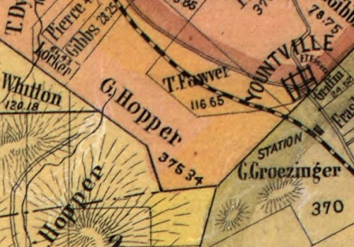
Captain George Yount, Captain John Grigsby, and James Harbin are the key players in the history of Yountville. Napa County was established immediately after California became a state on September 9, 1850. At that time, one of the earliest priorities was to determine the route of a new county road on the west side of the valley from Napa to Calistoga. The initially proposed road was to follow the old 1845 wagon trail through the gap between Yount Butte and the hills to the west. But that route, on reaching the area south of Yountville, would have to cross land owned by Craig, Harbin, and Charles Hopper.
In 1850, Hopper was the first buyer of part of Yount’s Rancho Caymus land grant: 650 acres in the southwest corner – just west of Yount Butte. Problems also existed closer to the town of Napa with the initial and first relocation of the 1850s county road proposals. Many alternate routes were considered. Then, in December 1854, the Napa County Board of Supervisors appointed two Viewers to help County Surveyor Emil d’Hemmecourt with a second relocation. On January 3, 1855, the newly proposed route (one half mile east of existing first relocation) went north from the Redwood/Trancas Road intersection along the Grigsby/Harbin boundary (now Yount Street) to a point on Yount’s southern boundary line at the surveyor’s stake set by Ide in 1847. The relocation route was approved by the supervisors on January 13, 1855 and declared a public route. This route and its specific location at Yount’s property became the key intersection for the development of the town of Yountville. As soon as the new county road became official, Yountville town planning began in earnest.