Berryessa, California History
History of Berryessa Valley
Jun
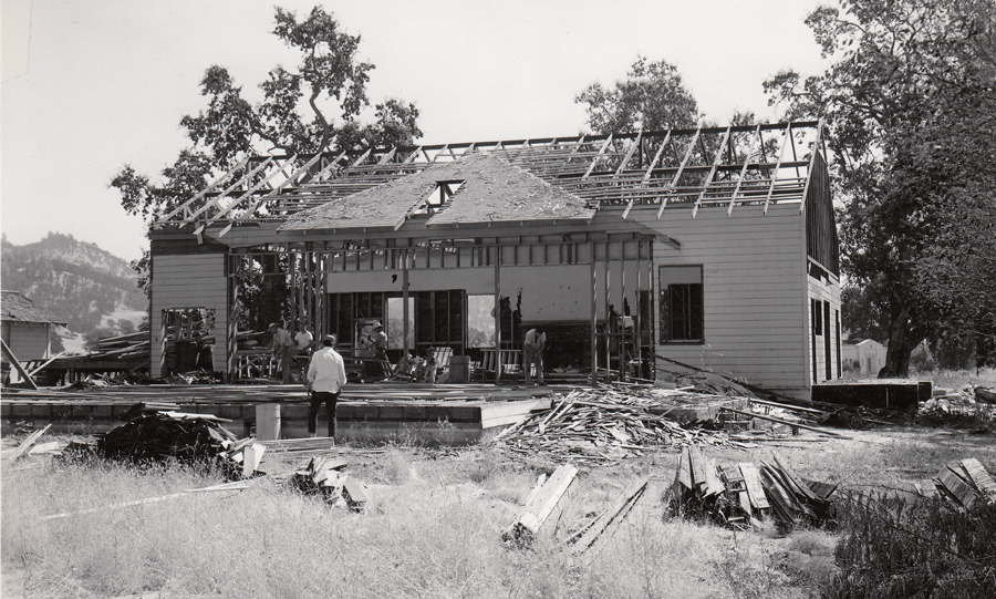
What follows is a transcription from a photograph album in the NCHS collections called “The Buildings of Lake Berryessa.” This album was the property of Paul C. Donovan, a park ranger at Lake Berryessa.
The document was used for a tour by land and air, possibly on February 21, 1955. All spelling, phrasing/terminology, stylistic flourishes, and punctuation are reproduced exactly as shown on the original document.
HISTORY OF BERRYESSA VALLEY
BERRYESSA was once a valley so rich and idyllic that the Nomadic Pomo Indians could live a life of ease off the game and natural vegetation there. In later days, farmers fought gun battles to protect their holdings and claim jumpers were a constant threat. Life could be violent even in those pleasant surroundings. One Thomas Lofton killed a settler in a land dispute in 1860 and made his excape after facing down the sheriff and his posse. A rancher named John See shot and killed a claim jumper that same year, only to be gunned down in the dusty main street of MONTICELLO the year of 1872, the climax of an old feud with another rancher.
The ORIGINAL luckless LANDOWNERS were JOSE JESUS and SISTO BERRYESSA, who obtained a 36,000-area grant from the Mexican government in 1843. The brothers built a 90 foot long adobe hacienda and settled down to the good life of raising cattle and breeding fine horses which they would race at the drop of a sombrero. Gradually they sold their acreage to the arriving Americanos to pay off their gambling and other debts [ed note: including debts incurred from taking squatters to court to defend their property rights]. The last piece of land owned by SISTO BERRYESSA and his wife was sold at the Sheriff’s auction in 1860 to settle a $1,653. judgment. Sisto lived out his life in a rude cabin near hat is now known as Spanish Flat, near the cemetery on Loop road.
There were two main roads out: One down the narrow Putah Creek Canyon to Winters into the Sacramento Valley, Known as highway 28. The other was through the road at Steele Canyon and over the mountains into Napa, known as highway 37.
AS EARLY AS 1906 proposal were being made to throw a dam across Putah Creek and create a vast reservoir in the Valley. It wasn’t until the 1940’s- 1948 that the project made headway. After a 1951 bond issue to build a local dam upstream, (above Knoxville) failed to pass, the Bureau of Reclamation with a $47 million appropriation launched its Monticello Dam.
LAKE BERRYESSA IS THERESULT OF THE SOLANO PROJECT
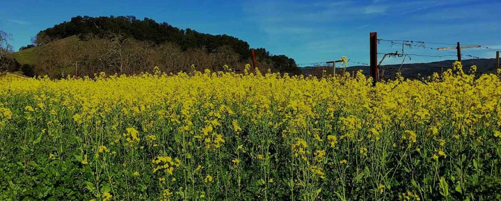
BERRYESSA was once a valley so rich with grade I and II soils of fetile farmlands of the valley in which the town of Monticello was located, but it was not given up by the farmers without fight. As we now look down from the Monticello Dam site into the fertile valley, please join me in taking a trip and tour on the completely new relocated highway 128. The valley stripped of trees, farm buildings, bridges, will soon be plain dusty steep slopes and a complete flat cleared floor that will soon be filled with the beautiful water as we see it today. Watch the two caterpillar work together in clearing the steep slopes, working as a team-one letting the other down steep slopes on a Cable. This method is used where hills are too steep or dangerous to be worked alone. All ranchers in the valley must face progress in motion and see Monticello and ranch homes gone forever.